


Newsletter Subscribe
Enter your email address below and subscribe to our newsletter
[forminator_form id="25163"]

All voices matter
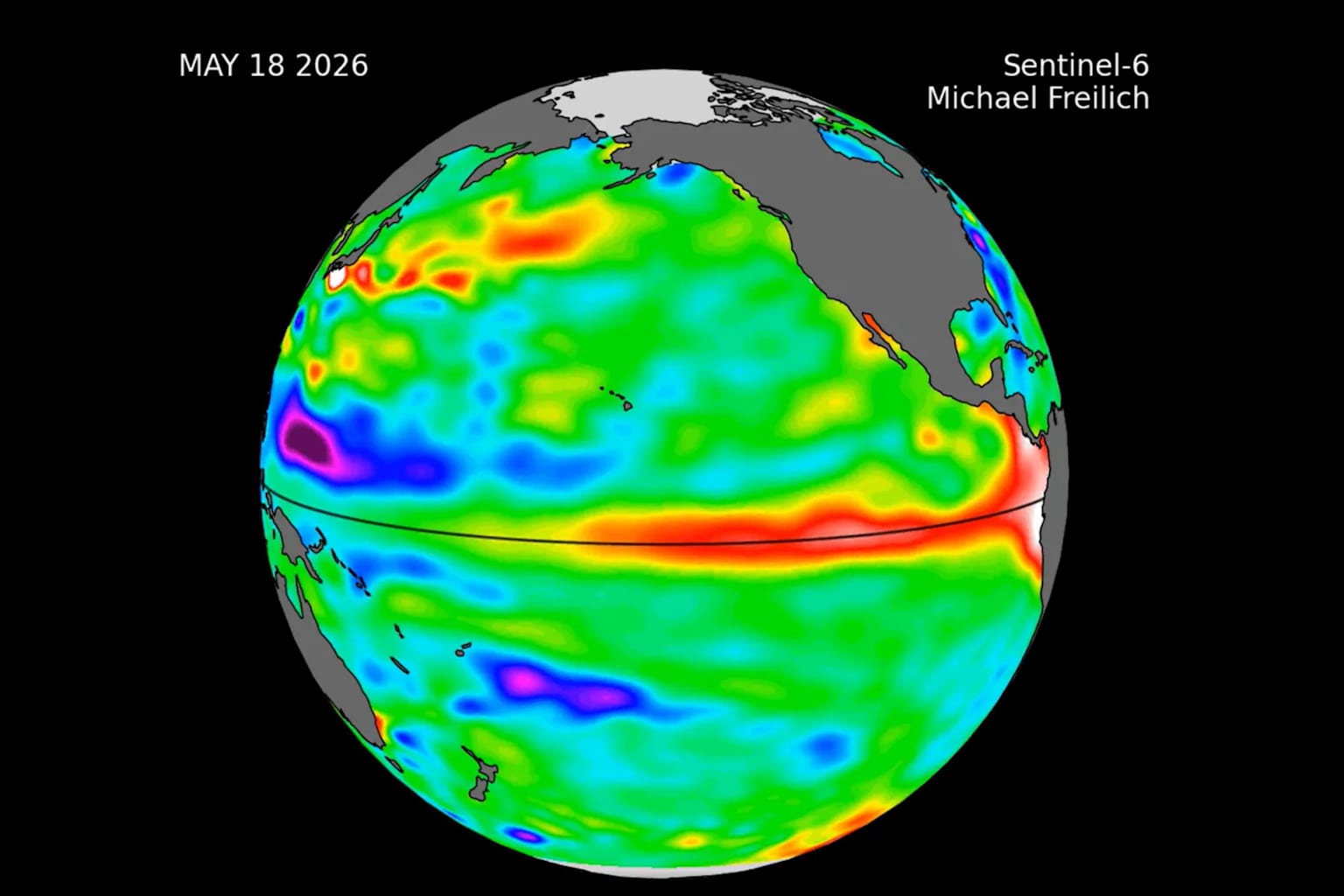
washingtonpost+1carbonbriefnewsweek+1The 2026 El Niño has officially become the strongest on record, with sea surface temperatures in a key stretch of the central Pacific surpassing any measurement in more than 170 years of observations — and the event is still months from its expected peak.
As of Sunday, September 20, the average ocean temperature anomaly in the Niño 3.4 region reached 3.05°C above the 1991–2020 average, according to the Washington Post, exceeding the previous record of 3.02°C set at the peak of the 2015–16 event in November of that year. Carbon Brief's analysis, using daily data from NOAA's Optimum Interpolation Sea Surface Temperature dataset, placed the anomaly at 3.07°C as of September 19, calling the milestone "remarkable".carbonbrief+1
What makes this event exceptional is not only its intensity but its timing. The previous record was set in mid-November 2015, when that El Niño was near its peak. The current event has surpassed it in mid-September, with roughly two to three months of strengthening still ahead. Every strong El Niño on record has continued to intensify after mid-September, typically peaking between November and January.washingtonpost+2
A NOAA spokesperson told Newsweek on Monday that El Niño is expected to continue strengthening through November and December. Forecast models compiled by Carbon Brief project a peak monthly anomaly of around 4.1°C later this year, with every single model run exceeding the 2015–16 record. NOAA has assigned a greater than 90 percent probability that the event will reach its maximum category intensity.newsweek+2
The World Meteorological Organization said El Niño is now firmly established and warned governments and communities to prepare for extreme weather through 2027. The WMO expects wetter-than-normal conditions in parts of East Africa, Central Asia, southern Europe, and western North America, while drier conditions are more likely across parts of the Indian subcontinent and Australia.bolnews
For the United States, the strongest effects are typically felt from late fall through winter. El Niño tends to supercharge the jet stream across the southern half of the country, bringing cooler, wetter conditions to the South and warmer, drier weather to the North. Winter snowfall forecasts are already showing a strong Super El Niño signature, with above-normal snow potential across the Sierra Nevada, Southern Rockies, and Central Plains.severe-weather+1
Because El Niño's effect on global temperatures typically lags the Pacific warming by several months, most of the impact on annual averages will be felt in 2027 rather than 2026. Carbon Brief's most recent quarterly analysis found 2026 already on track to be the warmest or second-warmest year on record, with an update in early October set to examine what a record El Niño means for the year ahead.carbonbrief
"See that red line? That's 2026," wrote WFLA-TV chief meteorologist Jeff Berardelli in a post on X announcing the record. "Every other bold line are the strongest El Niño's on record. 2026 is in a league of its own."newsweek


